| Bert de Ruiter |
| Wim Kohsiek |
The Tuxer Alps in Tyrol are a part of the Central Alps between "Wipptal
and Zillertal".
It is separated from the "Zillertaler Alps by the "Tuxer Joch"
(2338 m).
The highest elevations are the Lizumer Reckner (2886 m), Geier (2858 m),
Rastkogel (2762 m), Hirzer (2725 m) and Glungezer (2677 m).
The tour plan suggests the following itinerary:
| Day 1: | from Hochfügen to Rastkogelhütte. |
| Day 2: | from Rastkogelhütte via Rastkogel to the Weidenerhütte. |
| Day 3: | from Weidenerhütte to Wildofen v.v. |
| Day 4: | from Weidenerhütte via Naflingkoepfl and Hoher Kopf and back to the Weidenerhütte. |
| Day 5: | from Weidenerhütte to the Lizumerhütte. |
| Day 6: | from Lizumerhütte to Geierspitze v.v. |
| Day 7: | from Lizumerhütte to Hippoldspitze v.v. |
During this roundtrip you can choose for a more demanding alternative route
on day 1 and day 7
Overall this tour can be rated as medium light (WS+
,
wenig schwierig).
The huts mentioned below will be visited in this tour.
These huts are all open during the touring season, click the link for additional
information.
|
||
|
||
|
|
|
|
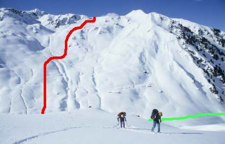
Day 1. Red track D1-02 to D1-03, Green track D1-01A to D1-031. |
|
|
|
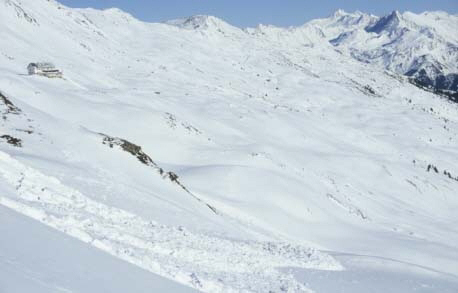
Day 1. Released avalanche near Sidanjoch (D1-04). Rastkogelhut in left corner of photo. |
|
|
|
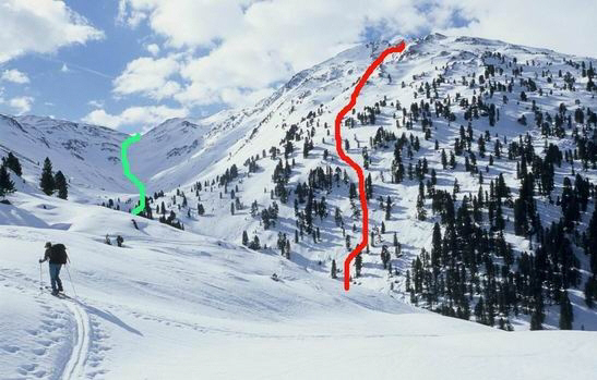
Day 5. Red track To Hobarjoch (D2-07 to D5-01). Green track from Geiseljoch to Weidenerhut.. |
The Tourplan is written in English.